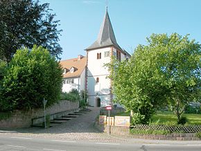
Höchst im Odenwald
Aspect
| Höchst im Odenwald | |||
| — comună din Germania[*] — | |||
 | |||
| |||
Höchst im Odenwald (Germania) Poziția geografică în Germania | |||
| Coordonate: 49°47′57″N 8°59′39″E / 49.799166666667°N 8.9941666666667°E | |||
|---|---|---|---|
| Țară | |||
| Land | |||
| Regierungsbezirk | Darmstadt | ||
| District rural[*] | |||
| Suprafață[1] | |||
| - Total | 30,51 km² | ||
| Altitudine | 177 m.d.m. | ||
| Populație (2022) | |||
| - Total | 10.319 locuitori | ||
| Fus orar | UTC+1 | ||
| Cod poștal | 64739 | ||
| Prefix telefonic | 06163 | ||
| Localități înfrățite | |||
| - Bělotín[*] | Cehia | ||
| - Montmélian | Franța | ||
| Prezență online | |||
| site web oficial GeoNames OpenStreetMap relation | |||
 | |||
| Modifică date / text | |||
Höchst im Odenwald este o comună din landul Hessa, Germania.
Note
[modificare | modificare sursă]- ^ Alle politisch selbständigen Gemeinden mit ausgewählten Merkmalen am 31.12.2018 (4. Quartal) (în germană), Statistisches Bundesamt[*], accesat în
Legături externe
[modificare | modificare sursă]![]() Materiale media legate de Höchst im Odenwald la Wikimedia Commons
Materiale media legate de Höchst im Odenwald la Wikimedia Commons
| |||||||


