
Fișier:MulberryB - Piers.jpg
Rezoluții mai mari nu sunt disponibile.
MulberryB_-_Piers.jpg (799 × 588 pixeli, mărime fișier: 184 KB, tip MIME: image/jpeg)
| Acest fișier se află la Wikimedia Commons. Consultați pagina sa descriptivă acolo. |
Descriere fișier
| Descriere |
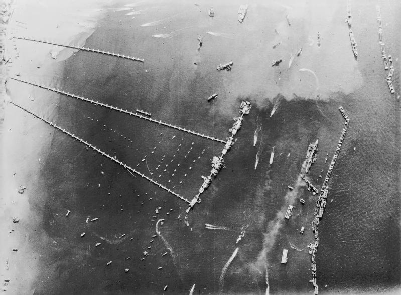
An aerial view of the pierhead and breakwater at the artificial 'Mulberry B Harbour' at Arromanches (Goosberry 3). |
|||
| Dată | ||||
| Sursă |
|
|||
| Autor | Royal Air Force official photographer | |||
| Alte versiuni | ibiblio.org a collaboration of the centerforthepublicdomain.org |

| Poziția aparatului de fotografiat | | Vizualizați poziția acestei și a altor imagini la: OpenStreetMap |
|---|
Licențiere
This work created by the United Kingdom Government is in the public domain.
This is because it is one of the following:
HMSO has declared that the expiry of Crown Copyrights applies worldwide (ref: HMSO Email Reply)
|
 |
Istoricul fișierului
Apăsați pe Data și ora pentru a vedea versiunea trimisă atunci.
| Data și ora | Miniatură | Dimensiuni | Utilizator | Comentariu | |
|---|---|---|---|---|---|
| actuală | 18 ianuarie 2012 23:38 | | 799x588 (184 KB) | Cobatfor | IWM photo |
| 31 mai 2005 13:34 |  | 633x572 (75 KB) | W.wolny |
Utilizarea fișierului
Următoarele pagini conțin această imagine:
Utilizarea globală a fișierului
Următoarele alte proiecte wiki folosesc acest fișier:
- Utilizare la azb.wikipedia.org
- Utilizare la cs.wikipedia.org
- Utilizare la de.wikipedia.org
- Utilizare la el.wikipedia.org
- Utilizare la en.wikipedia.org
- Utilizare la fa.wikipedia.org
- Utilizare la fr.wikipedia.org
- Utilizare la he.wikipedia.org
- Utilizare la ja.wikipedia.org
- Utilizare la la.wikipedia.org
- Utilizare la nl.wikipedia.org
- Utilizare la pl.wikipedia.org
- Utilizare la sr.wikipedia.org
- Utilizare la ta.wikipedia.org
- Utilizare la uk.wikipedia.org
- Utilizare la uz.wikipedia.org
- Utilizare la vi.wikipedia.org
- Utilizare la www.wikidata.org