
Fișier:Ionian Islands.svg

Mărimea acestei previzualizări PNG a acestui fișier SVG: 532 × 547 pixeli. Alte rezoluții: 233 × 240 pixeli | 467 × 480 pixeli | 747 × 768 pixeli | 996 × 1.024 pixeli | 1.992 × 2.048 pixeli.
Mărește rezoluția imaginii (Fișier SVG, cu dimensiunea nominală de 532 × 547 pixeli, mărime fișier: 281 KB)
| Acest fișier se află la Wikimedia Commons. Consultați pagina sa descriptivă acolo. |

|
This map has been uploaded by Electionworld from en.wikipedia.org to enable the |
Descriere fișier
| Descriere |
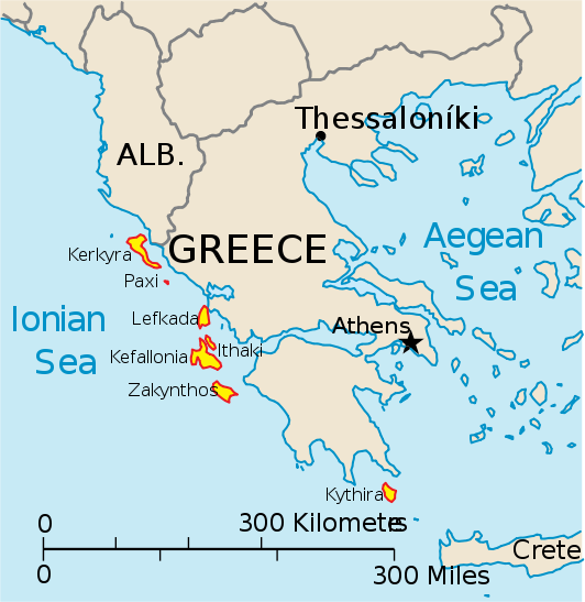
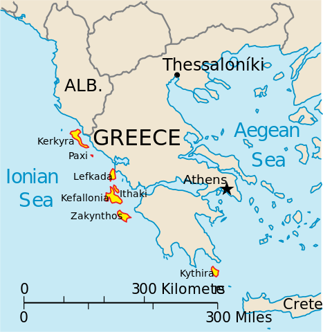
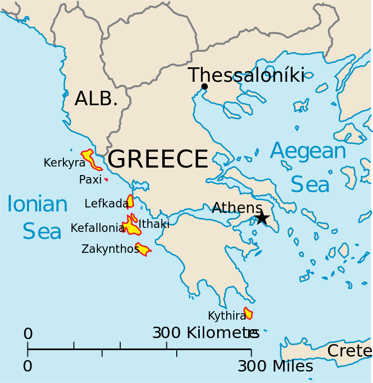
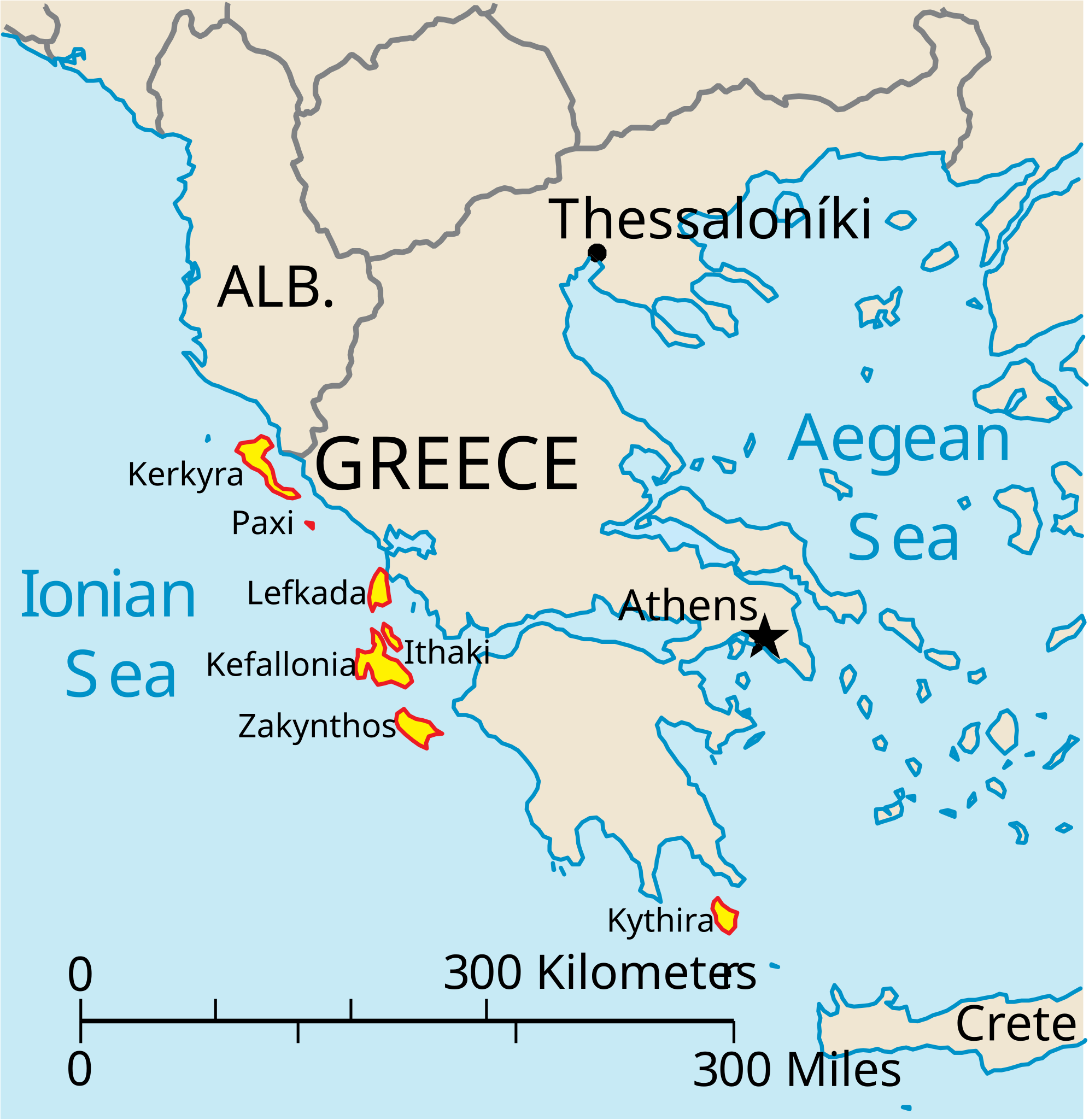
English: Map of the Ionian Islands off Greece. |
| Dată | |
| Sursă | Operă proprie, Original vector data taken from the 2006 CIA World Factbook map of Europe. All modifications were made by me, and are free for anyone to use for any purpose. |
| Autor | Electionworld |
| Alte versiuni |
Version en français : |
Licențiere
This image is in the public domain because it contains materials that originally came from the United States Central Intelligence Agency's World Factbook.
|
 |
Istoricul fișierului
Apăsați pe Data și ora pentru a vedea versiunea trimisă atunci.
| Data și ora | Miniatură | Dimensiuni | Utilizator | Comentariu | |
|---|---|---|---|---|---|
| actuală | 4 aprilie 2010 17:39 | | 532x547 (281 KB) | Kmusser | rm Macedonia label, not important to the map and avoids POV issue |
| 20 decembrie 2006 23:17 |  | 532x547 (258 KB) | Electionworld | {{ew|en|IMeowbot}} == Summary == Map of the Ionian Islands off Greece. Original vector data taken from the 2006 CIA World Factbook map of Europe. All modifications were made by me, and are free for anyone to use for any purpose. == Licensing == {{PD-US |
Utilizarea fișierului
Următoarele pagini conțin această imagine:
Utilizarea globală a fișierului
Următoarele alte proiecte wiki folosesc acest fișier:
- Utilizare la ar.wikipedia.org
- Utilizare la ast.wikipedia.org
- Utilizare la be.wikipedia.org
- Utilizare la bg.wikipedia.org
- Utilizare la ceb.wikipedia.org
- Utilizare la ce.wikipedia.org
- Utilizare la cy.wikipedia.org
- Utilizare la da.wikipedia.org
- Utilizare la de.wikipedia.org
- Utilizare la en.wikipedia.org
- Utilizare la et.wikipedia.org
- Utilizare la fa.wikipedia.org
- Utilizare la fi.wikipedia.org
- Utilizare la fr.wikipedia.org
- Utilizare la he.wikipedia.org
- Utilizare la hr.wikipedia.org
- Utilizare la hu.wikipedia.org
- Utilizare la hyw.wikipedia.org
- Utilizare la id.wikipedia.org
- Utilizare la it.wikipedia.org
Vizualizați utilizările globale ale acestui fișier.