
Fișier:Zarit incident map.png

Rezoluții mai mari nu sunt disponibile.
Zarit_incident_map.png (519 × 298 pixeli, mărime fișier: 67 KB, tip MIME: image/png)
| Acest fișier se află la Wikimedia Commons. Consultați pagina sa descriptivă acolo. |
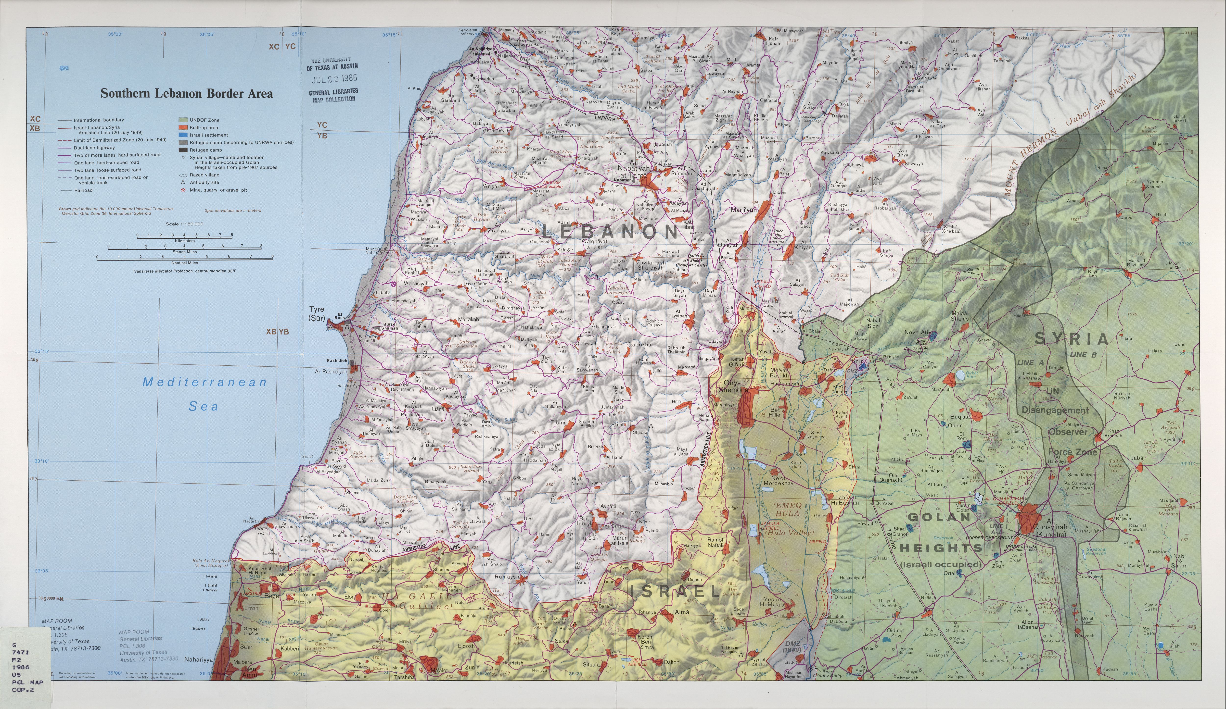
| Descriere | Map of Zar'it and vicinity illustrating the localities involved in the Zar'it-Ayta ash-Shab incident which sparked the 2006 Israel-Lebanon conflict. |
| Dată | Incident happened on July 12 2006. Upload August 17 2006. |
| Sursă | Uploaded as en:Image:Zarit incident map.png. Based on http://www.lib.utexas.edu/maps/middle_east_and_asia/lebanon_southern_border_1986.jpg |
| Autor | Original map is the work of the Central Intelligence Agency. Modifications by en:User:ChrisO. |
| Permisiune (Reutilizarea acestui fișier) |
PD |
| This image is a work of a Central Intelligence Agency employee, taken or made as part of that person's official duties. As a Work of the United States Government, this image or media is in the public domain in the United States.
|

|
Istoricul fișierului
Apăsați pe Data și ora pentru a vedea versiunea trimisă atunci.
| Data și ora | Miniatură | Dimensiuni | Utilizator | Comentariu | |
|---|---|---|---|---|---|
| actuală | 20 august 2006 02:58 | | 519x298 (67 KB) | Jkelly | {{Information |Description=Map of Zar'it and vicinity illustrating the localities involved in the Zar'it-Ayta ash-Shab incident which sparked the 2006 Israel-Lebanon conflict. |Source=Uploaded as en:Image:Zarit incident map.png. Based on htt |
Utilizarea fișierului
Următoarele pagini conțin această imagine:
Utilizarea globală a fișierului
Următoarele alte proiecte wiki folosesc acest fișier:
- Utilizare la ar.wikipedia.org
- Utilizare la azb.wikipedia.org
- Utilizare la bn.wikipedia.org
- Utilizare la de.wikipedia.org
- Utilizare la en.wikipedia.org
- Utilizare la hr.wikipedia.org
- Utilizare la no.wikipedia.org
- Utilizare la pl.wikipedia.org
- Utilizare la pt.wikipedia.org
- Utilizare la sh.wikipedia.org
- Utilizare la sk.wikipedia.org
- Utilizare la www.wikidata.org