
Fișier:USACE Coffeeville Lock and Dam Tombigbee.jpg
Mărimea acestei previzualizări: 800 × 534 pixeli. Alte rezoluții: 320 × 214 pixeli | 640 × 428 pixeli | 1.024 × 684 pixeli | 1.500 × 1.002 pixeli.
Mărește rezoluția imaginii (1.500 × 1.002 pixeli, mărime fișier: 769 KB, tip MIME: image/jpeg)
| Acest fișier se află la Wikimedia Commons. Consultați pagina sa descriptivă acolo. |
| Descriere |
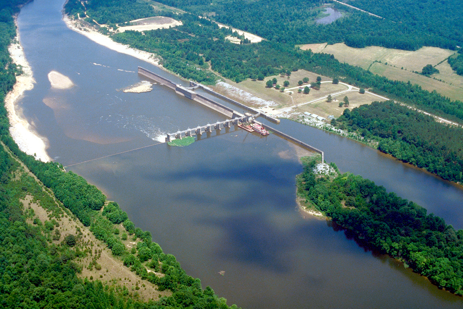
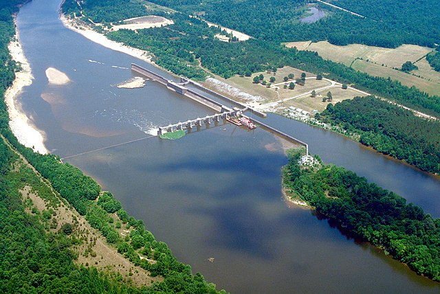
English: Aerial view of Coffeeville Lock and Dam on the Tombigbee River, spanning the border between Choctaw and Clarke Counties near Coffeeville, Alabama, USA. View is downriver to the east. The U.S. Army Corps of Engineers constructed the dam and lock on the river to provide a nine-foot navigation channel. Coffeeville Lock and Dam is the last lock and dam down the Tombigbee River (or the first, if travelling up the Tombigbee or Black Warrior River). There are no locks and dams between Coffeeville and the Gulf of Mexico. |
|||
| Loc | Coffeeville, Alabama, USA 31°45′25.72″N 88°7′44.47″W / 31.7571444°N 88.1290194°W |
|||
| Dată | ||||
| Sursă |
U.S. Army Corps of Engineers Digital Visual Library Image page Image description page Digital Visual Library home page |
|||
| Autor | U.S. Army Corps of Engineers, photographer not specified or unknown | |||
| Permisiune (Reutilizarea acestui fișier) |
|
Istoricul fișierului
Apăsați pe Data și ora pentru a vedea versiunea trimisă atunci.
| Data și ora | Miniatură | Dimensiuni | Utilizator | Comentariu | |
|---|---|---|---|---|---|
| actuală | 19 aprilie 2007 06:14 | | 1.500x1.002 (769 KB) | DanMS | {{Information2 | Description = {{en|Aerial view of Coffeeville Lock and Dam on the Tombigbee River, spanning the border between Choctaw and Clarke Counties near Coffeefille, Alabama, USA. View is downriver to the east. The U.S. Army Corps of Engineers |
Utilizarea fișierului
Următoarele pagini conțin această imagine:
Utilizarea globală a fișierului
Următoarele alte proiecte wiki folosesc acest fișier:
- Utilizare la arz.wikipedia.org
- Utilizare la bg.wikipedia.org
- Utilizare la ceb.wikipedia.org
- Utilizare la de.wikipedia.org
- Utilizare la en.wikipedia.org
- Utilizare la es.wikipedia.org
- Utilizare la frr.wikipedia.org
- Utilizare la fr.wikipedia.org
- Utilizare la gl.wikipedia.org
- Utilizare la it.wikipedia.org
- Utilizare la pl.wikipedia.org
- Utilizare la uk.wikipedia.org
- Utilizare la www.wikidata.org