
Fișier:St. Johns, Arizona (101310387).jpg

Mărește rezoluția imaginii (1.600 × 1.200 pixeli, mărime fișier: 610 KB, tip MIME: image/jpeg)
| Acest fișier se află la Wikimedia Commons. Consultați pagina sa descriptivă acolo. |
.jpg)
Descriere fișier
| Descriere |
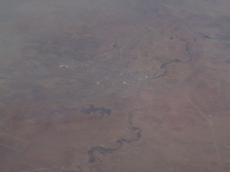
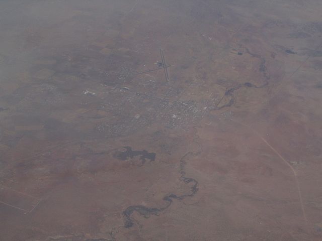
St. Johns is the only city in and the county seat of Apache County, Arizona, United States. It is located along U.S. Route 180, mostly west of where that highway intersects with U.S. Route 191. According to 2006 Census Bureau estimates, the population of the city was 3,538. St. Johns was first settled in 1873 by the Barth Brothers. They were bought out in 1879 by Ammon M. Tenney. St. Johns has been the county seat for almost all of the county's history. When the county was created on February 24, 1879, Snowflake was designated the county seat. After the first election in fall 1879, county government was set up in St. Johns, though it was moved again in 1880, to Springerville; in 1882 St. Johns again became the county seat, and it has remained so ever since. St. Johns is home to the Apache County Historical Society Museum and has four National Register of Historic Places: Isaacson Building, Lower Zuni River Archeological District, Lyman Lake Rock Art Site, and Rattlesnake Point Pueblo. St. Johns is near the Placerias Quarry, the site where dozens of Placerias fossils were discovered in 1930 by Charles Camp and Samuel Welles, of the University of California, Berkeley. St. Johns is along the shortest and most scenic route from Phoenix to Albuquerque, New Mexico. Within an hour's drive from St. John's are Apache-Sitgreaves National Forest, Petrified Forest National Park, the Painted Desert, and Lyman Lake State Park, as well as Indian reservations such as the Navajo Nation, Fort Apache Indian Reservation, San Carlos Apache Indian Reservation, and Zuni Indian Reservation. en.wikipedia.org/wiki/St._Johns,_Arizona en.wikipedia.org/wiki/Wikipedia:Text_of_Creative_Commons_... |
| Dată | |
| Sursă | St. Johns, Arizona |
| Autor | Ken Lund from Reno, Nevada, USA |
| Poziția aparatului de fotografiat | | Vizualizați poziția acestei și a altor imagini la: OpenStreetMap |
|---|
.jpg¶ms=034.506910_N_-109.361858_E_globe:Earth_type:camera_source:Flickr_&language=ro)
Licențiere
- Sunteți liber:
- să partajați cu alții – aveți dreptul de a copia, distribui și transmite opera
- să adaptați – aveți dreptul de a adapta opera
- În următoarele condiții:
- atribuind – Trebuie să atribuiți opera corespunzător, introducând o legătură către licență și indicând dacă ați făcut schimbări. Puteți face asta prin orice metodă rezonabilă, dar nu într-un fel care ar sugera faptul că persoana ce a licențiat conținutul v-ar susține sau ar aproba folosirea de către dumneavoastră a operei sale.
- partajând în condiții identice – Dacă modificați, transformați sau creați pe baza acestei opere, trebuie să distribuiți opera rezultată doar sub aceeași licență sau sub o licență similară acesteia.
| This image was originally posted to Flickr by Ken Lund at https://flickr.com/photos/75683070@N00/101310387. It was reviewed on 3 decembrie 2015 by FlickreviewR and was confirmed to be licensed under the terms of the cc-by-sa-2.0. |
Istoricul fișierului
Apăsați pe Data și ora pentru a vedea versiunea trimisă atunci.
| Data și ora | Miniatură | Dimensiuni | Utilizator | Comentariu | |
|---|---|---|---|---|---|
| actuală | 4 decembrie 2015 00:43 | | 1.600x1.200 (610 KB) | INeverCry | Transferred from Flickr via Flickr2Commons |
Utilizarea fișierului
Următoarele pagini conțin această imagine:
Utilizarea globală a fișierului
Următoarele alte proiecte wiki folosesc acest fișier:
- Utilizare la ar.wikipedia.org
- Utilizare la arz.wikipedia.org
- Utilizare la bg.wikipedia.org
- Utilizare la ca.wikipedia.org
- Utilizare la ceb.wikipedia.org
- Utilizare la ce.wikipedia.org
- Utilizare la cy.wikipedia.org
- Utilizare la es.wikipedia.org
- Utilizare la eu.wikipedia.org
- Utilizare la he.wikipedia.org
- Utilizare la ht.wikipedia.org
- Utilizare la hu.wikipedia.org
- Utilizare la it.wikipedia.org
- Utilizare la lld.wikipedia.org
- Utilizare la no.wikipedia.org
- Utilizare la pl.wikipedia.org
- Utilizare la pt.wikipedia.org
- Utilizare la sr.wikipedia.org
- Utilizare la tt.wikipedia.org
- Utilizare la uz.wikipedia.org
- Utilizare la vo.wikipedia.org
- Utilizare la www.wikidata.org
.jpg)