
Fișier:Arizona ref 2001.jpg

Mărimea acestei previzualizări: 506 × 599 pixeli. Alte rezoluții: 203 × 240 pixeli | 405 × 480 pixeli | 677 × 802 pixeli.
Mărește rezoluția imaginii (677 × 802 pixeli, mărime fișier: 283 KB, tip MIME: image/jpeg)
| Acest fișier se află la Wikimedia Commons. Consultați pagina sa descriptivă acolo. |
| Descriere |
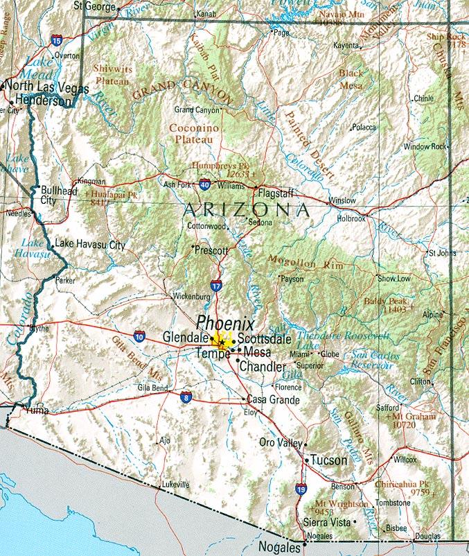
English: Map of Arizona. Shaded relief map with state boundaries, forest cover, place names, major highways. Portion of "The National Atlas of the United States of America. General Reference", compiled by U.S. Geological Survey 2001, printed 2002 |
|||
| Dată | ||||
| Sursă | Courtesy of the University of Texas Libraries, The University of Texas at Austin | |||
| Autor | U.S. Geological Survey 2001 | |||
| Permisiune (Reutilizarea acestui fișier) |
|
Istoricul fișierului
Apăsați pe Data și ora pentru a vedea versiunea trimisă atunci.
| Data și ora | Miniatură | Dimensiuni | Utilizator | Comentariu | |
|---|---|---|---|---|---|
| actuală | 22 ianuarie 2006 19:10 | | 677x802 (283 KB) | Severino666~commonswiki | :''"Courtesy of the University of Texas Libraries, The The University of Texas at Austin.'' *'''Source:''' [http://en.wikipedia.org/wiki/Image:Texas_2002.jpg University of Texas Libraries] |
Utilizarea fișierului
Următoarele pagini conțin această imagine:
Utilizarea globală a fișierului
Următoarele alte proiecte wiki folosesc acest fișier:
- Utilizare la de.wikipedia.org
- Utilizare la en.wikipedia.org
- Utilizare la hr.wiktionary.org
- Utilizare la lt.wikipedia.org
- Utilizare la pt.wikipedia.org
- Utilizare la zh.wikipedia.org