Fișier:AmchitkaAlaskaLoc.png

Conținutul paginii nu este suportat în alte limbi.
De la Wikipedia, enciclopedia liberă

AmchitkaAlaskaLoc.png(300 × 219 pixeli, mărime fișier: 14 KB, tip MIME: image/png)

Acest fișier se află la Wikimedia Commons. Consultați pagina sa descriptivă acolo.

Descriere fișier

Descriere

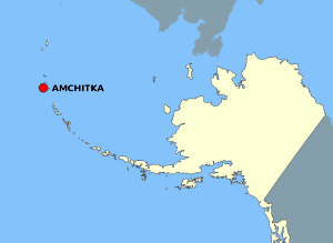
This map is a derivative work of a map layer from nationalatlas.gov, which states: "We have begun by collaboratively building "frameworks," the essential map layers that provide a foundation for all other maps. These basic layers, including small-scale harmonized information on North American roads, water, boundaries and the like, are being offered here for the first time. Like all other raw data and documentation offered here on nationalatlas.gov, these frameworks can be downloaded at no cost and used freely without copyright concerns or license restrictions."[1]

I donate the modifications and the resulting work to the public domain.
Sursă see above
Autor National Atlas - DW: Jakew

Licențiere

Public domain
This map was obtained from an edition of the National Atlas of the United States. Like almost all works of the U.S. federal government, works from the National Atlas are in the public domain in the United States.
Online access: NationalAtlas.gov | 1970 print edition: Library of Congress, Perry-Castañeda Library

čeština | Deutsch | English | français | Bahasa Indonesia | italiano | македонски | മലയാളം | sicilianu | 中文 | 中文(简体)‎ | 中文(繁體)‎ | +/−

Jurnalul original al încărcărilor

Pagina originală de descriere a fost aici. Toate numele de utilizator de mai jos sunt pentru en.wikipedia.
  • 2006-10-08 16:15 Jakew 300×219×8 (14678 bytes) This map is a derivative work of a map layer from nationalatlas.gov, which states: "We have begun by collaboratively building "frameworks," the essential map layers that provide a foundation for all other maps. These basic layers, including small-scale ha

Captions

Add a one-line explanation of what this file represents

Items portrayed in this file

subiectul reprezentat

image/png

checksum engleză

29373e1014db60b020fe042aeb20de37cd506fdd

219 pixel

300 pixel

Istoricul fișierului

Apăsați pe Data și ora pentru a vedea versiunea trimisă atunci.

Data și oraMiniaturăDimensiuniUtilizatorComentariu
actuală3 august 2007 00:20Miniatură pentru versiunea din 3 august 2007 00:20300x219 (14 KB)Adam~commonswiki{{Information |Description=This map is a derivative work of a map layer from nationalatlas.gov, which states: "We have begun by collaboratively building "frameworks," the essential map layers that provide a foundation for all other maps. These basic layer

Următoarele pagini conțin această imagine:

Utilizarea globală a fișierului

Următoarele alte proiecte wiki folosesc acest fișier: