
Fișier:Norad map.png
Rezoluții mai mari nu sunt disponibile.
Norad_map.png (702 × 326 pixeli, mărime fișier: 55 KB, tip MIME: image/png)
| Acest fișier se află la Wikimedia Commons. Consultați pagina sa descriptivă acolo. |
| Descriere |
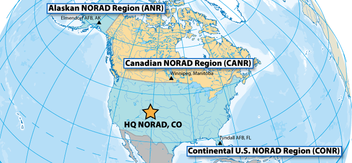
Français : La zone opérationnelle du NORAD est divisée en trois régions. L'Alaskan Norad Region, le Canadian Norad et le Continental U.S Norad. |
||||||
| Dată | Dată necunoscută | ||||||
| Sursă | http://www.noradsanta.org/fr/anorad.html | ||||||
| Autor | Necunoscut | ||||||
| Permisiune (Reutilizarea acestui fișier) |
|
||||||

Istoricul fișierului
Apăsați pe Data și ora pentru a vedea versiunea trimisă atunci.
| Data și ora | Miniatură | Dimensiuni | Utilizator | Comentariu | |
|---|---|---|---|---|---|
| actuală | 17 octombrie 2010 09:40 | | 702x326 (55 KB) | L'amateur d'aéroplanes | {{Information |Description={{fr|1=La zone opérationnelle du NORAD est divisée en trois régions. L'Alaskan Norad Region, le Canadian Norad et le Continental U.S Norad. }} |Source=http://www.noradsanta.org/fr/anorad.html |Author=Inconnu |Date=Inconnu |P |
Utilizarea fișierului
Următoarele pagini conțin această imagine:
Utilizarea globală a fișierului
Următoarele alte proiecte wiki folosesc acest fișier:
- Utilizare la ca.wikipedia.org
- Utilizare la de.wikipedia.org
- Utilizare la es.wikipedia.org
- Utilizare la fi.wikipedia.org
- Utilizare la fr.wikipedia.org
- Utilizare la it.wikipedia.org
- Utilizare la nl.wikipedia.org
- Utilizare la pl.wikipedia.org
- Utilizare la vi.wikipedia.org